The short version
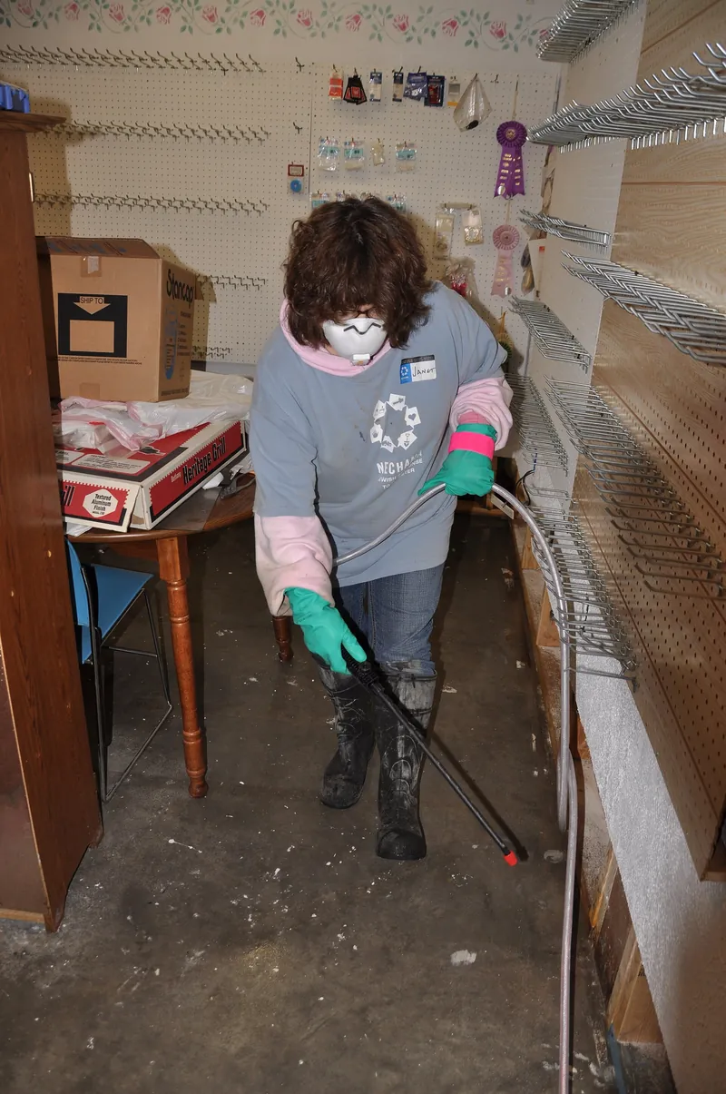
Houston floods because the land is flat, the clay soil drains poorly, storms can stall and the bayous are slow. HCFCD says a major flood hits somewhere in Harris County about every two years. Allison in 2001 and Harvey in 2017 are the best known. Flood water is Category 3, so cleanup is a contamination job.
Does Houston flood a lot?
Yes. The Harris County Flood Control District says a major flood occurs somewhere in Harris County about every two years. That does not mean every street floods that often, only that the county as a whole has a long record of floods large enough to damage homes.
The county is also very wet. The National Weather Service lists a 1991 to 2020 normal of 51.84 inches of rain a year at Bush Intercontinental Airport.
Rain that arrives in a few hours can matter more than the yearly total, which is why the biggest floods here come from single storms. This site is a referral service, not a contractor, so this page explains the causes and what they mean for a house.
Why does Houston flood so often?
Houston flooding comes from flat land, clay soil that drains poorly, slow storms and a lot of paving. Wikipedia's Hurricane Harvey article describes the region as a very flat flood plain with clay-based soils, where storms tend to move slowly and drop huge amounts of rain over an extended period.
Each piece adds to the others. Flat ground gives water little slope to run off. Clay holds water at the surface instead of letting it soak in.
A slow storm keeps feeding rain into the same watersheds for hours or days. The article names Tropical Storm Claudette in 1979 and Tropical Storm Allison in 2001 as examples of storms that stalled over the area. Warm Gulf water can add to a storm's rainfall, and the same article notes that Harvey crossed water well above average temperatures.
Then add the city. Buffalo Bayou's Wikipedia page says urbanization has put thousands of people in vulnerable areas and has affected how often and how hard floods hit. See the Harvey article and the Buffalo Bayou page.
How do Houston's bayous flood?
Bayous are slow, wide channels that carry rain from the neighborhoods to Galveston Bay. When rain comes faster than a bayou can carry it, the water spreads into the floodplain beside it. Wikipedia describes Buffalo Bayou and Brays Bayou as slow-moving rivers, and the San Jacinto River and Buffalo Bayou as meandering and mud-laden.
HCFCD runs the county's drainage network, which is split into watersheds, each draining into its own waterway. Its project list names Armand, Brays, Buffalo, Carpenters, Cedar, Greens, Halls, Hunting, Jackson, Luce, Sims, Vince and White Oak bayous, plus creeks such as Clear, Cypress and Spring. Which one drains your street is the first thing to learn about your risk.
Brays Bayou shows how it plays out. Wikipedia says the Brays watershed is heavily urbanized, with a relative lack of flood control infrastructure, and is extremely prone to flash flooding.
It also notes that Alief, along the Brays, had the region's first flood control district, created in 1909. Our flood zone map guide shows how to check which mapped zone your address is in.
What were the big Houston floods?
The county has a long list of floods, from the 1929 and 1935 events that led to flood control to the storms of the last decade. The table lists the ones the sources name. Each row reflects what the cited source says, not a full count of every flood.
| Event | When | What the source says | Source |
|---|---|---|---|
| Floods that led to HCFCD | 1929 and 1935 | The Texas Legislature created HCFCD in 1937 after them | HCFCD |
| Tropical Storm Allison | June 2001 | 22 deaths and 73,000 damaged residences listed; over $5 billion in property damage | HCFCD |
| Memorial Day Flood | May 26, 2015 | Listed as one of four major floods on Buffalo Bayou since 2015 | Wikipedia |
| Tax Day Flood | 2016 | Listed in the same group of four | Wikipedia |
| Hurricane Harvey | August 2017 | At least 160,000 structures flooded in Harris and Galveston counties | NHC |
| Tropical Storm Imelda | 2019 | Listed in the same group of four | Wikipedia |
The sources disagree on peak rainfall for Imelda, so this page gives no total for it. For the history behind the 2001 storm, read the HCFCD flooding history page.
What happened to Houston in Tropical Storm Allison?
Allison hit in June 2001 and showed how much rain a slow storm can leave behind. HCFCD says the storm was expected to dump as much as 80 percent of the area's average annual rainfall over much of Harris County. It lists 22 fatalities, 73,000 damaged residences and over $5 billion in property damage.
Wikipedia adds that about 6,000 homes along Brays Bayou flooded and the Texas Medical Center was inundated. The same page says damage at one university health science center alone topped $740 million.
The 2001 storm is the reason the county built a public mapping tool: HCFCD says its Flood Education Mapping Tool replaced one first launched for the Tropical Storm Allison Recovery Project. After any flood, the signs of water damage guide lists what to look for.
What happened in Hurricane Harvey?
Harvey made landfall near Rockport on August 26, 2017 as a category 4 hurricane, then stalled and dropped record rain. The National Hurricane Center's report calls it the most significant tropical cyclone rainfall event in United States history. Totals of 36 to 48 inches were recorded in the Houston metro area.
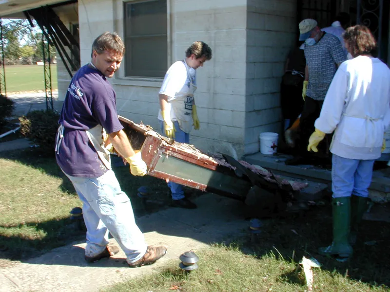

The NHC report says nine of the 19 official river gauges in Harris County recorded all-time high flood stages. At least 160,000 structures flooded in Harris and Galveston counties combined, and 36 of the storm's direct deaths were in Harris County.
The report notes that the highest storm total, 60.58 inches near Nederland, was outside Houston. The NWS also lists a one-day record of 16.07 inches at Bush Intercontinental on August 27, 2017.
Harvey is a reminder that the maps and the rainfall can both be exceeded. See hurricane water damage in Houston for wind, surge and flood claims. The NHC report has the full record.
What are Addicks and Barker, and why do they matter?
Addicks and Barker are two Army Corps of Engineers flood control reservoirs in west Houston that hold back water to protect Buffalo Bayou downstream. Most of the time they are dry and wooded. In a major storm they fill, and what happens at the dams can decide who floods.
Wikipedia says both were authorized in 1938 and Addicks Dam was completed in 1948. Together they hold about 410,000 acre-feet, and Barker provides no flood reduction to properties upstream of the dams.
During Harvey, the NHC says controlled releases from both reservoirs were made to prevent dam failures, which further flooded some areas. HCFCD says it was the first time in the dams' history of more than seventy years that homes upstream of the reservoirs flooded from rising water in them.
The lesson is that a home near a reservoir may need a different question than one near a bayou. A reservoir, floodway or flood pool is its own item on the Texas seller's notice, covered in the flood zone map guide.
Does development make Houston flooding worse?
The sources say development has an effect, but they do not give one number. Wikipedia says urbanization of the Buffalo Bayou watershed has placed thousands of people in vulnerable areas and has affected the frequency and intensity of floods. Brays Bayou's heavy development combined with limited flood control infrastructure keeps it prone to flash floods.
People often point to concrete and paving. The better-sourced point is that Houston grew over flat, clay land that was already a flood plain, and that channels and reservoirs were added later.
Wikipedia lists channelization of the Brays in the 1950s after severe floods, and a $480 million project to retrofit that watershed. A 2024 report cited on the Buffalo Bayou page found that sewer infrastructure also contributed to flooding in part of that watershed.
For a homeowner, the takeaway is practical. Floods here come from more than one cause, so a map check, a look at your drainage and a flood insurance conversation all matter.
What does Houston flooding mean for water damage at home?
Most flood damage in a house is a contaminated-water problem. The IICRC S500 standard places rising flood water from rivers and streams, and sewage, in Category 3, the grossly contaminated group. Wet drywall, insulation, carpet and padding in that water usually come out, and that is a job to confirm with a provider.
Insurance is the other half. FEMA says most homeowners insurance does not cover flood, and Triple-I says sewer backups are not covered by flood insurance either.
Flood from outside needs flood cover, and sewer backup needs its own endorsement. The CDC says to clean and dry a flooded home fully and quickly, within 24 to 48 hours, and to remove soaked carpet and upholstery that cannot be dried right away.
Drying has a time limit. The flood cleanup page and the mold after water damage guide explain why. For a storm that came through the roof or a window rather than the ground, read roof leaks and storm water damage.
How do I get ready for the next Houston flood?
Start with your address, your insurance and a plan for the first day. You cannot control the weather, but you can check your risk, close the coverage gap and keep records. Do this before the forecast turns, because flood policies usually have a waiting period.
- Look up your flood zone with the steps in the flood zone map guide and save a FIRMette.
- Ask your agent about flood and sewer backup cover. FEMA's manual describes a 30-day waiting period for new policies, with limited exceptions.
- Photograph each room and your valuables, and store the files off site.
- Find your main water shutoff and breaker panel so you can reach them quickly.
- Learn which bayou or creek drains your area and where water has stood on your street.
- Stay out of moving water. Ready.gov says six inches can knock a person down and one foot can sweep a vehicle away.
The water damage guides cover what to do after water gets in, and the prevention guide covers the smaller leaks that are not storm related.
Sources: HCFCD, Harris County flooding history; HCFCD, Flooding Impacts in Connection with the Reservoirs; HCFCD, Harris County's Watersheds; HCFCD, About the District; HCFCD, Flood Education Mapping Tool; NHC, Hurricane Harvey report; NWS Houston/Galveston, IAH normals; Wikipedia, Hurricane Harvey; Wikipedia, Buffalo Bayou; Wikipedia, Brays Bayou; Wikipedia, Addicks Reservoir; Wikipedia, Barker Reservoir; IICRC S500; FEMA, Don't have flood insurance; FEMA NFIP Flood Insurance Manual; Triple-I, Which disasters are covered; CDC, About Mold and Your Health; Ready.gov, Floods.